
< Publications
Final Data
These are the final datasets that were inputs for this paper:
Zhang, X., Wright, K., Passalacqua, P., Simard, M., & Fagherazzi, S., 2022. Improving channel hydrological connectivity in coastal hydrodynamic models with remotely-sensed channel networks. Journal of Geophysical Research: Earth Surface, 127.
DOI: 10.1029/2021JF006294
INPUT DATASETS
- Delta-X: Acoustic Doppler Current Profiler Channel Surveys, Coastal Louisiana, 2021 | view dataset
- Pre-Delta-X: Channel Bathymetry of the Atchafalaya Basin, LA, USA, 2016 | view dataset
- Pre-Delta-X: Water Levels across Wax Lake Outlet, Atchafalaya Basin, LA, USA, 2016 | view dataset
- Pre-Delta-X: Aboveground Biomass and Vegetation Maps, Wax Lake Delta, LA, USA, 2016 | view dataset
MODEL DATA
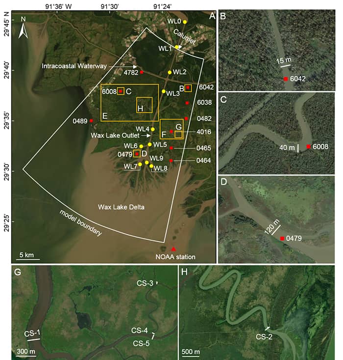
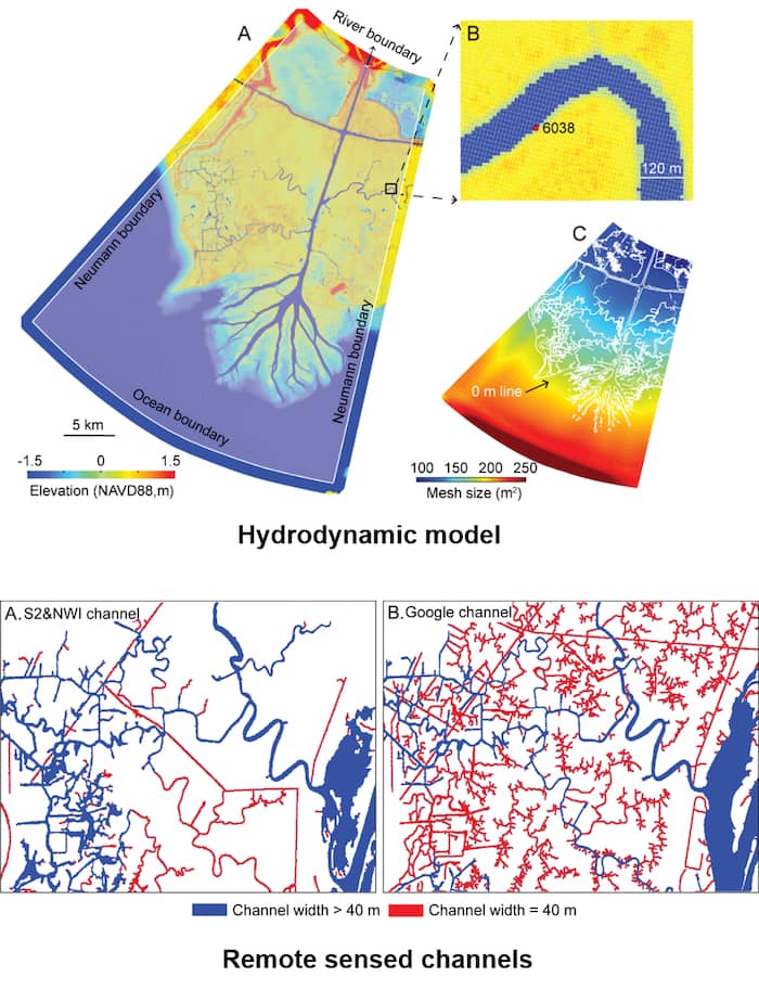
Calibrated Delft3D model for the Wax Lake Delta (~10m resolution). Using remote sensed channel network, 18 water level measurements, and 5 discharge measurements. View dataset description.
- Delft3D model setup files: download (97 MB)
- Channel networks: download (3 MB)
- Modified topography: download (70 MB)
- Hydrodynamic model results: download (551 MB)
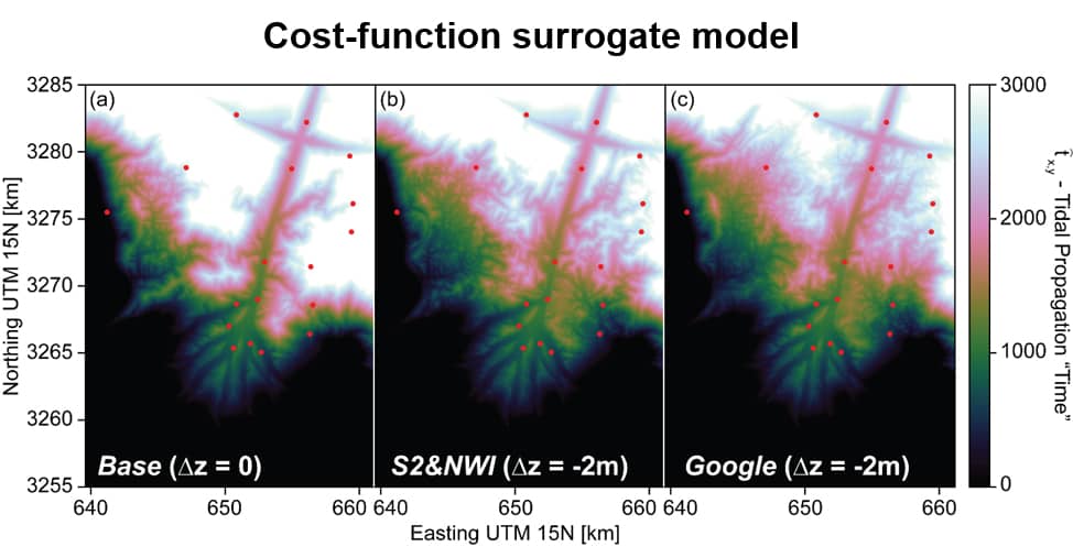
- Cost function model: download (15 KB)
If you end up using this data, please cite Delta-X with this acknowledgement:
The NASA Delta-X project is funded by the Science Mission Directorate’s Earth Science Division through the Earth Venture Suborbital-3 Program NNH17ZDA001N-EVS3.