< Presentations
Preliminary Data
Final datasets are accessible from the Data Download page.
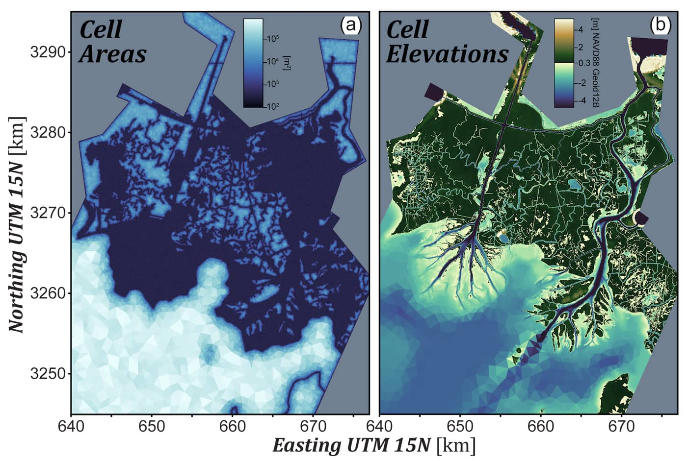
Preliminary ANUGA hydrodynamic models of the Atchafalaya basin
This was presented at the 2021 AGU Fall Meeting:
EP34C-05. (Model) Form Follows Function: Connectivity-Preserving Mesh Construction using Multi-Source Remote Sensing and Image Processing
Kyle A Wright and Paola Passalacqua
If you end up using this data, please cite Delta-X with this acknowledgement:
The NASA Delta-X project is funded by the Science Mission Directorate’s Earth Science Division through the Earth Venture Suborbital-3 Program NNH17ZDA001N-EVS3.
DESCRIPTION
Python codes and outputs for two ANUGA hydrodynamic models of the Wax Lake and Atchafalaya Delta system. The two versions of the model are titled the Connectivity-Preserving Mesh (CPM) and the Unrefined Mesh (UM). The UM has a relatively uniform 25m mesh size throughout the inland region, whereas the CPM has a more spatially-variable mesh size refined using optical, radar, and topographic remote sensing layers to be less computationally demanding with similar accuracy. Both models are semi-calibrated to align with the Pre-Delta-X campaign in October 2016, and share the same tidal and discharge boundary conditions, as well as friction parameterizations. Codes for the mesh refinement process are also given. See README.txt for more details.
View model code (hosted at UT Austin)