
< Blog
August 29, 2021
Merely interrupted
By Marc SimardToday Hurricane Ida hit Louisiana.
 Hurricane Ida’s destructive path
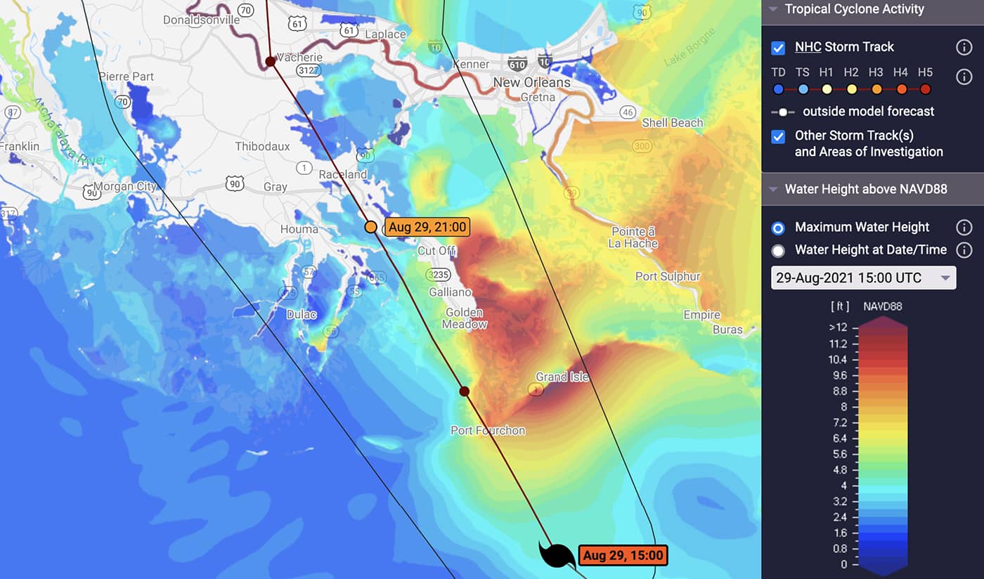
As Ida progresses from the Gulf of Mexico, the region of Grand-Isle/Port-Fouchon will see storm surges greater than 12 feet.
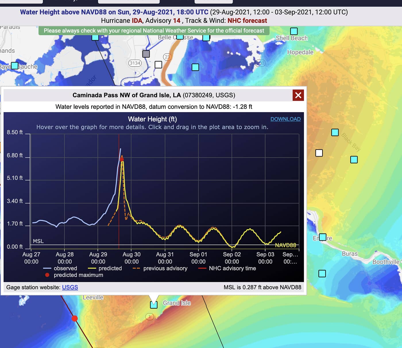 Grand Isle is already under 7 feet (2.1 meters) of water at this time (i.e. ~13:00 Central)
Hurricane Ida, currently cat-4 will be down to cat-3 at 16:00CT (21:00 UTC) as it reaches east of Houma (Southwest of New Orleans) with maximum winds of 119mph and gust of 145mph. Ida’s largest storm surges will be observed in its path’s upper right quadrant (12 to 3 o’clock), a region that includes Grand Isle, Barataria bay, Shell beach and New Orleans.
The Delta-X domain will be somewhat spared since the Terrebonne and Atchafalaya basins are located within the left quadrants (West) of Ida’s path. The hurricane path grazes the domain to the East aiming toward Houma.
 Storm surge in the Wax Lake Delta will reach 2–3 feet
 Storm surge in the Terrebonne Basin will reach 2–3 feet
Storm surge in the Delta-X domain will reach 2 to 3 feet. While relatively mild compared to Grand Isle, the surge will cause significant salt-water intrusion across the Delta-X domain. Remember the surface slope in the region is only a few centimeters per kilometers. Thus, this 1 meter surge will have tremendous reach that will greatly impact infrastructure and vegetation. Hopefully, the Delta-X gauges network will be minimally destroyed.
Delta-X is merely interrupted. The new data collected with AVIRIS-NG before and after the hurricane will be a valuable resource to assess the scale of Ida’s impact on vegetation and channels. AVIRIS-NG will fly once surge and following rain waters recede and skies clear. We are planning for flights between September 14–24. On the other hand, radar flights from UAVSAR and AirSWOT will resume in a couple days, capturing receding waters across the region. The Delta-X teams are re-assessing location of flight bases in case airports, supplies, electricity and communications are not readily accessible. Within the next few weeks, the JPL, UNC and LSU field teams will safely return to collect soil cores, water level gauges and ADCP transects.